
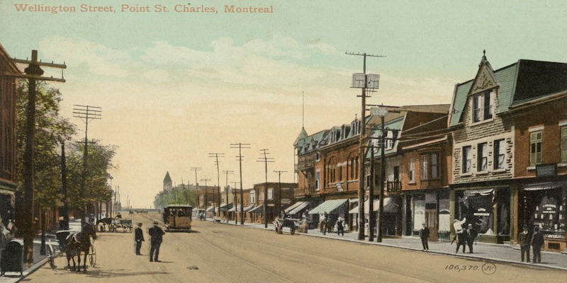
This walk will take you thru the old industrial neighbourhood of Pointe-Saint-Charles, also known as “The Point”. It once had the reputation as being the toughest neighbourhood in Canada and is steeped in history with settlers from New France that began farming in the late 1600’s to the beginning of industry and modes of transportation with the Lachine Canal, the Victoria Bridge and the Grand Trunk Railway in the mid-1800’s. With this industrialization came Irish, Scots, English, as well as Polish and Ukrainian. The French-Canadians and Irish were a majority in The Point, and this area is considered the heart of Irish Montreal. Pointe-Saint-Charles is bordered on the north by the Lachine Canal, to the west by Autoroute 15, to the south by the St.Lawrence River and to the east by the Port of Montreal.
The walk we have highlighted on this page will take you thru the streets, see some old buildings, walk along the Lachine Canal, reflect on old industry and see some of the first industry housing that was built in Canada on Sebastopol Street. We did this walk on Sunday July 4, 2021, starting at 9:34AM and finishing at 12:32PM. We measured the total distance at 6.4KM (4M). The temperature was 24C (75F) when we started and when we finished it was 27C (80F). It was a sunny day, with few clouds. It is not a difficult walk, majority is flat terrain.
A large part of The Point includes the massive railroad yard that cuts off the north-east area of The Point that includes The Victoria Bridge, The Irish Stone Monument and the demolished “Goose Village” (Victoriatown). We have this area mapped to a separate walk already done that can be viewed here: Victoriatown (a.k.a. Goose Village) – Walk Montreal
Below map highlights our walk in Pointe-Saint-Charles and also the key points of interest.

Former Baptist church at 2183 Wellington Street , built in 1900, now a Sikh Temple.

Bain Hogan Bath at 2188 Wellington Street – beautiful Art Deco building built in 1931.

Photo of Hogan Bath from 1930’s ( credit BANQ).

Parc Marguerite-Bourgeoys. Walk thru this park to the south-east corner and go down Place Dublin.

Parc Marguerite-Bourgeoys.

Maison Saint-Gabriel, built 1698. Just off of Place Dublin.
Dedicated to preserve the history going back over 300 years, with the settling of New France, farming and the Congregation of Notre-Dame.
Marguerite Bourgeoys also created a school here, which included the “Filles du Roi” (the King’s Daughters), which were young women recruited in France to make the journey to the new world to encourage families and increase the population with the male settlers/soldiers.


Railway behind Parc Marguerite-Bourgeoys. The railway played a crucial role in the history of this area..

Walk back thru the park back to Wellington and walk north on Rue Charlevoix.
Corner of Rue Charlevoix and Rue de Rozel.

Paul Patates (corner of Charlevoix and Coleraine Street). A local favourite that claims to make the best poutine in the city. What they do serve here is the original Emile Spruce Beer. (closed on Sunday, as we found out).

Lorne School -built in 1890, at 2387 Coleraine Street (also has an entrance on Ryde Street).
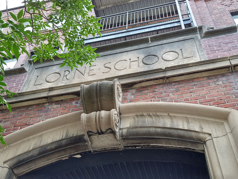
Lorne School.
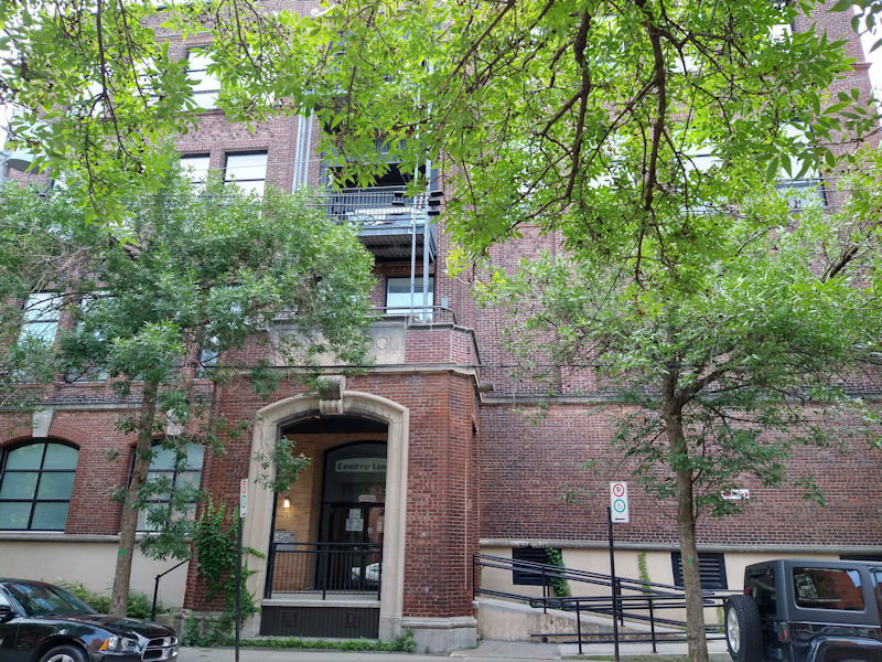
Lorne School.
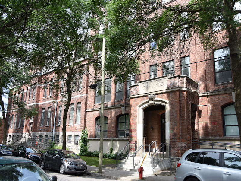
Old postcard image of Lorne School – early 1900’s (almost like a chateau).

Walk east on Coleraine Street.

Corner of Coleraine and Liverpool streets.

Walk north on Liverpool Street.

Parc de L’Irlande.

Turn left at Knox Street and go to Hibernia Street and walk to the underpass.

Underpass on Hibernia Street.

Bibliotheque Pointe St-Charles Library – built in 1891, it was the former Hibernia Fire Station, at 1050 Hibernia Street.

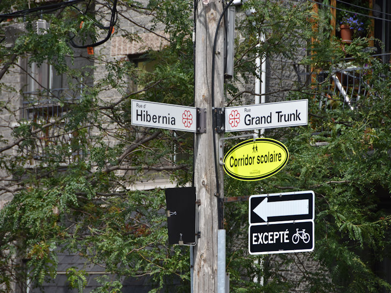
Corner of Hibernia and Grand Trunk streets.
Walk north on Rue de Laprairie

Saint-Gabriel School- built in 1878 at 2312 Centre Street.

Saint-Jean L’Evangeliste School – built in 1883 at 2325 Centre Street.

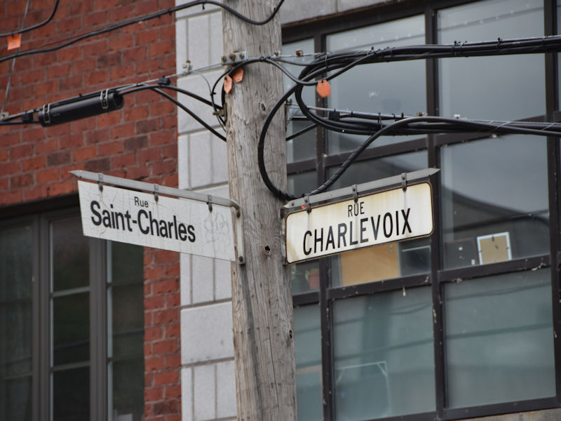
Walk west on Centre Street to Charlevoix and go one block up to Saint-Charles Street.
Walk back east on Saint-Charles Street.

Saint-Charles Street.

Saint-Charles Street.

Saint Gabriel’s Church – built in 1895 at 2157 Centre Street.

Saint Charles Church- built in 1899 at 2115 Centre Street.

Old postcard image of St. Gabriel and St. Charles Churches – early 1900’s.

Walk north on Rue Island and when you get to Saint-Patrick Street, turn right and walk up to the Pont des Seigneurs built in 1898 that spans the Lachine Canal with the Saint-Gabriel Locks.

The Belding Paul silk factory – built in 1884 at 1790 du Canal Street.

The Belding Paul silk factory – built in 1884 at 1790 du Canal Street.

You can see how massive the Belding industrial building was, with boats docking the Lachine Canal (credit BANQ).

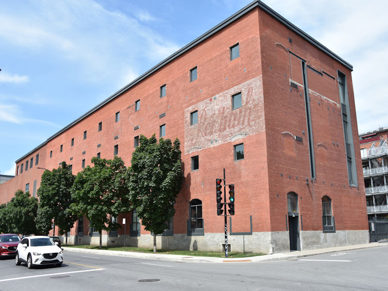
Walk east along the Lachine Canal on the south side and you will arrive at the Canada Sugar Refining factory – built in 1854.

Also massive at 12 acres! Canada Sugar Refining – circa 1904 (credit BANQ).

Canada Sugar Refining factory (also know as Redpath Sugar, was founded by John Redpath) – built in 1854.
Walk south on Shearer Street and you will see the impressive Northern Electric Company building- built in 1913. It covers the entire block of Saint-Patrick/Richardson/Shearer.

Northern Electric Company building- built in 1913.

Walk south to Grand Trunk Street to the Holy Ghost Ukrainian Church – built 1948 at 1795 Grand Trunk Street.

Continue east on Grand Trunk and then at Montmorency walk up to Centre Street to see the Holy Trinity Polish Church – built 1934 at 1660 Centre Street.

Continue east to Rue de Conde and Grand Trunk to see an old Savings Bank built in 1900.

Walk south-west on Wellington Street and at the corner of Rue de la Sucrerie, you will see the Wellington underpass in front of you.

Walk thru the underpass.

When you exit the underpass, you will see these street signs. You want to walk over to Rue de Sebastopol.

As you walk onto Rue de Sebastopol, you will see on your left a new ramp to walk up on. Go for it!. Wait until you see what awaits you!

The city made a cute little lookout with a bench and paving stones to look out over not just Sebastopol…

…but, also to look straight down neighbouring Favard Street….

…and also a great view of Rue Sebastopol, that has one of the first homes built for industry workers in 1856. Built by The Grand Trunk Railway, these buildings housed skilled workers from Great Britain to work in the Grand Trunk Railyards…

…another great view of these row houses and the street…and….

…if you look to your left (or east), you will see the massive railyards originally occupied by The Grand Trunk Railway.
In the distance you can see the elevated platform of the new REM rapid rail system. Behind the elevated REM, would be where the vanished neighbourhood of Goose Village (Victoriatown) stood.

Grand Trunk Railway yards, Pointe St. Charles 1898 (credit McCord Museum).

Grand Trunk Railway yards, Pointe St. Charles 1898 (credit McCord Museum).

You can also view the skyline of downtown Montreal from this observation point on Rue de Sebastopol.

Walk back along Sebastopol.

Rue de Sebastopol.

Turn west on Rue Favard, this is the corner of Favard and Rue de la Congregation.

When you get to Rue Ste Madeleine, walk north to Wellington.

At the corner of Wellington and Ste. Madeleine is an old Bank of Montreal building – built in 1901.

On Wellington Street, former dépanneur corner store echo’s days of past.

Continue walking east on Wellington and at the corner of Fortune and Wellington is Grace Church – built in 1891.

If you walk north on Fortune for just one block.

You can walk down Paris Street.

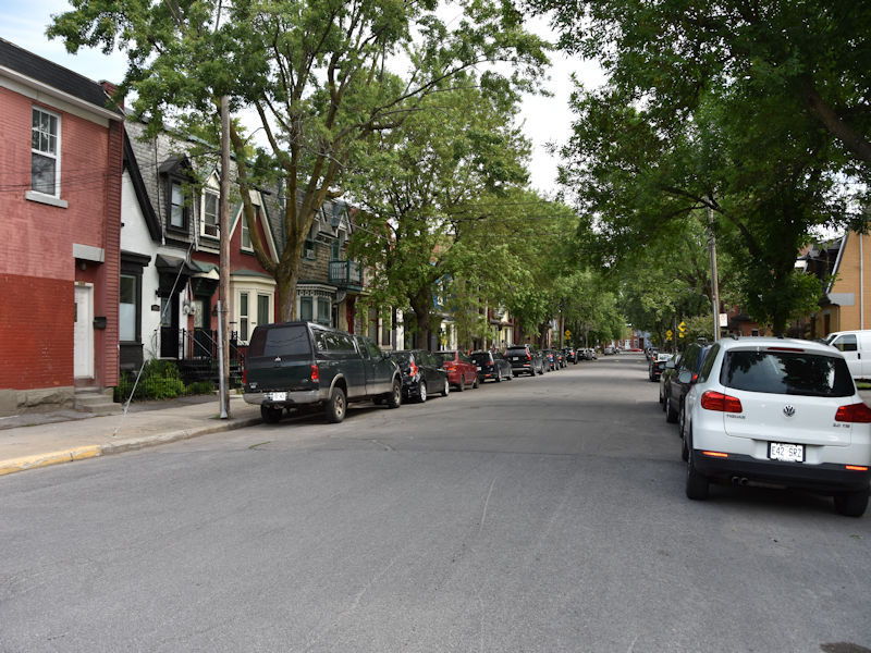
Head back to Wellington and continue west to where we started. Some homes on Wellington Street below.

Below is an excerpt from a 1913 map of Montreal showing the Pointe-Saint-Charles area. The purple circle indicates the area covered in the above walk we did. The blue circle shows the old Grand Trunk Railway Yard and the green circle shows where the vanished “Goose Village” (Victoriatown) neighbourhood once stood, before it was demolished by the City of Montreal.
You can see the walk we did in the past of “Goose Village” (Victoriatown) that includes The Irish Stone Monument and The Victoria Bridge, Here is the link: Victoriatown (a.k.a. Goose Village) – Walk Montreal

We hope you enjoy this walk as much as we did. The history here is incredible and the streets are a joy to walk.
I believe #17 was a Royal Bank, the last time that I know it was operating as a bank. (It may have been a Bank of Montreal branch earlier).
I also believe, for a time, that it served as a threatre.
thanks for info Ian
It was The Royal Bank