
Old Montreal, with it’s origins dating back to 1642 with Fort Ville-Marie and French settlers, is the subject of this walk. We will not go into detailed history, as this would require volumes of books and intense study. This is not a “tourist book” style walk, although it does cover many tourist sites in Old Montreal. This walk is to discover Old Montreal as it is and enjoy each step you take.
C and D wanted to highlight a city of grey stone and black wrought-iron, the shadows within streets and a colder look of autumn changing into winter so they photographed this walk in black and white.
The walk itself was not completed in one day, it was photographed and mapped out on four Saturdays in 2021: November 6, November 27, December 11 and December 18. You will see different buildings, alleys and streets from the 17th century thru to the 20th century. But, now that the route has been mapped out, (its about 3 km or just under 2 miles), you can do this walk in about 2 to 3 hours while stopping for photos. There will be a lot of sites and areas that we did not include, so feel free to continue on and make your own walk as well.
Note: we did not include the Old Port in this walk, due to it’s history this will be a separate walk by itself in 2022 titled “Montreal Harbour”.
So lets get on with it and walk Old Montreal !
Below Google map shows the key highlights of the walk, starting at # 1.
We started the walk at the Sir George-Étienne Cartier National Historic Site (456 – 462 Rue Notre Dame East, corner of Berri) – built in 1836-1838.

Louis-Joseph Papineau National Historic Site (440 Rue Bonsecours) – built in 1785.

Looking south on Rue Bonsecours with the Notre-Dame-de-Bon-Secours Chapel (the “Sailors Church”) – built in 1771.

Louis Viger House (415 Rue Bonsecours) – built 1765.

Pierre du Calvet House (401 Rue Saint-Paul East, corner Bonsecours) – built 1771.

Pierre du Calvet House (401 Rue Saint-Paul East, corner Bonsecours) – built 1771.

Notre-Dame-de-Bon-Secours Chapel (the “Sailors Church”) ( 400 Rue Saint Paul East) – built in 1771.

Looking west at corner of Bonsecours and Saint-Paul, with Marché Bonsecours on south side.

Looking at the rear of Notre-Dame-de-Bon-Secours Chapel on Rue de la Commune.

Marché Bonsecours on Rue de la Commune – built 1844-1847.

Marché Bonsecours on Rue de la Commune – built 1844-1847.

Marché Bonsecours on Rue Saint-Paul East – built 1844-1847.

Hotel Rasco (281 Rue Saint-Paul East) – built in 1835.

Step back in time to May 1842, when a 30 year old Charles Dickens visited Montreal during his North American visit. He stayed at Rasco’s Hotel (as seen above), entertained with the British Garrison theatrical players and also acted in and directed some plays at the Theatre Royal which stood somewhere between the Marche Bonsecours and Bonsecours Chapel. Below is the Theatre Royal programe published in The Gazette on Saturday May 28, 1842.

Up until the late 1950’s, there was a Charles Dickens Street. It ran north south, on the east side of Rasco’s Hotel, from Saint-Paul to the back of Chateau Ramezay. Below image is courtesy of BANQ – circa 1955..

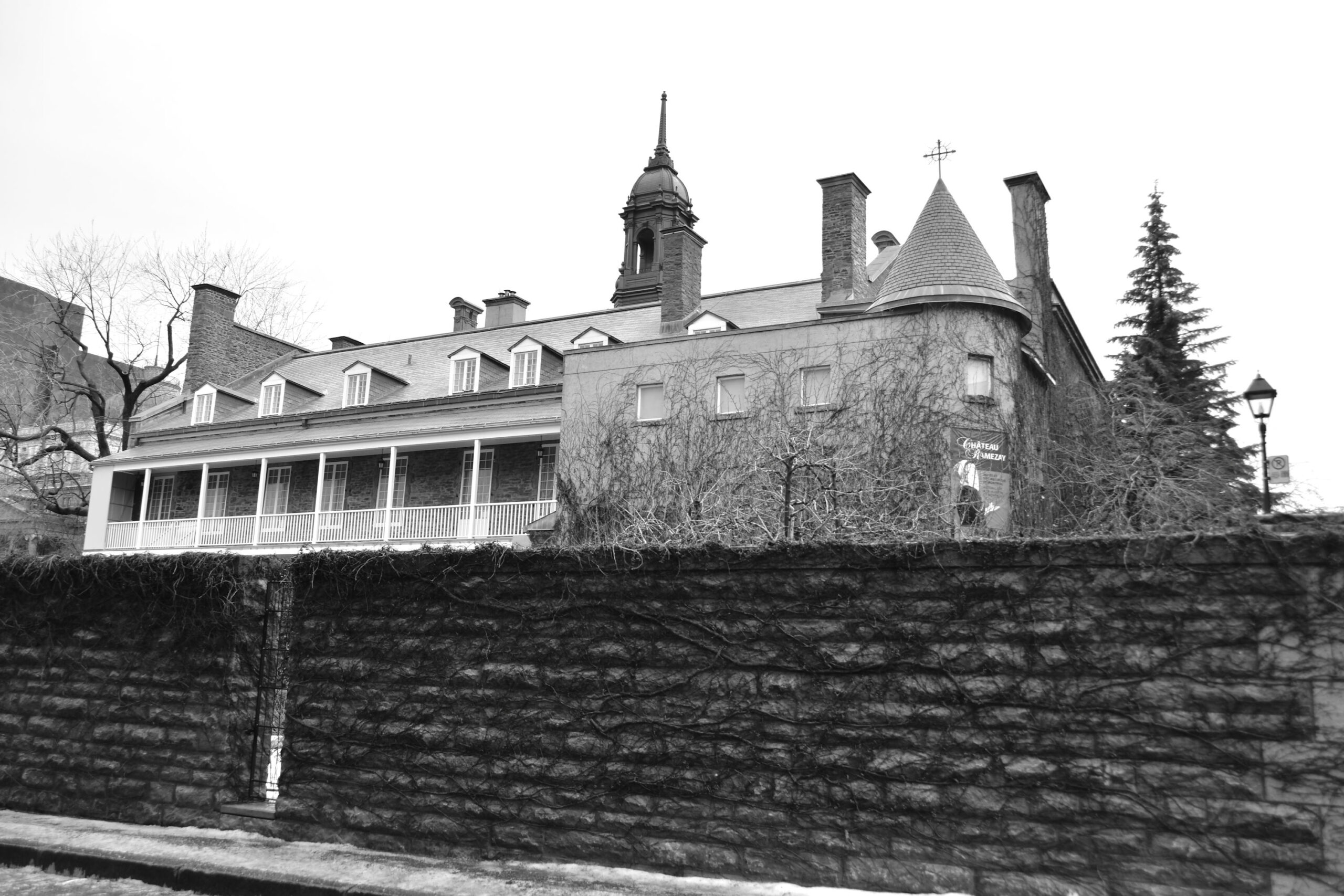
Château Ramezay (280 Rue Notre-Dame East) – built in 1705.

Château Ramezay (280 Rue Notre-Dame East) – built in 1705.

The rear of Château Ramezay (280 Rue Notre-Dame East) – built in 1705.
South end of Place Jacques-Cartier.

West side of Place Jacques-Cartier.

West side of Place Jacques-Cartier.

Rue Saint-Amable.

Rue Saint-Amable (the iron pegs for window shutters are still evident in many buildings).


Rue Saint-Paul.

Rue Saint-Vincent.

Rue Saint-Paul.

Edward William Gray House (427-429 Rue Saint-Vincent) – built in 1785.

Edward William Gray House (427-429 Rue Saint-Vincent) – built in 1785.

Original Hotel Richelieu (443 Rue Saint-Vincent) – built in 1858.

Original Hotel Richelieu (443 Rue Saint-Vincent) – built in 1858.
In December of 1880, the French actress, Sarah Bernhardt, arrived in Montreal to perform on stage. And six years later, in 1886, Crowfoot, chief of the Blackfoot Confederacy arrived in Montreal to see the cities of the east. Both stayed here at the Hotel Richelieu.

The drawing room at the Richelieu Hotel, circa 1890 (Wm Notman & Son) – credit Musée McCord Museum. You can imagine Sarah Bernhardt sitting here amongst guests.

The entrance to the Richelieu Hotel, circa 1890 (Wm Notman & Son) – credit Musée McCord Museum. And here is where Crowfoot would be looking out upon this city in the east.

Rue Saint-Gabriel.

Maison Clément-Sabrevois de Bleury (428-430 Rue Saint-Gabriel) – built in 1747.

Maison Clément-Sabrevois de Bleury (428-430 Rue Saint-Gabriel) – built in 1747.

Maison Clément-Sabrevois de Bleury (428-430 Rue Saint-Gabriel) – built in 1747.

Simon McTavish House (425 Rue Saint-Jean-Baptiste) – built in 1785.

Simon McTavish House (425 Rue Saint-Jean-Baptiste) – built in 1785.

Corner of Rue Saint-Jean-Baptiste and Rue de la Commune.

Rue Saint-Dizier – looking towards harbour.

Rue Saint-Dizier – looking towards city.

Corner of Saint-Paul and Saint-Sulpice.

Rue Saint-Paul.

Rue de la Capitale.

Rue de la Capitale.

Rue de la Capitale.

Place Royale.

Place Royale, as seen from de la Commune.

Skyline above Place Royale.

Place Royale, as seen from Rue Saint-Paul.

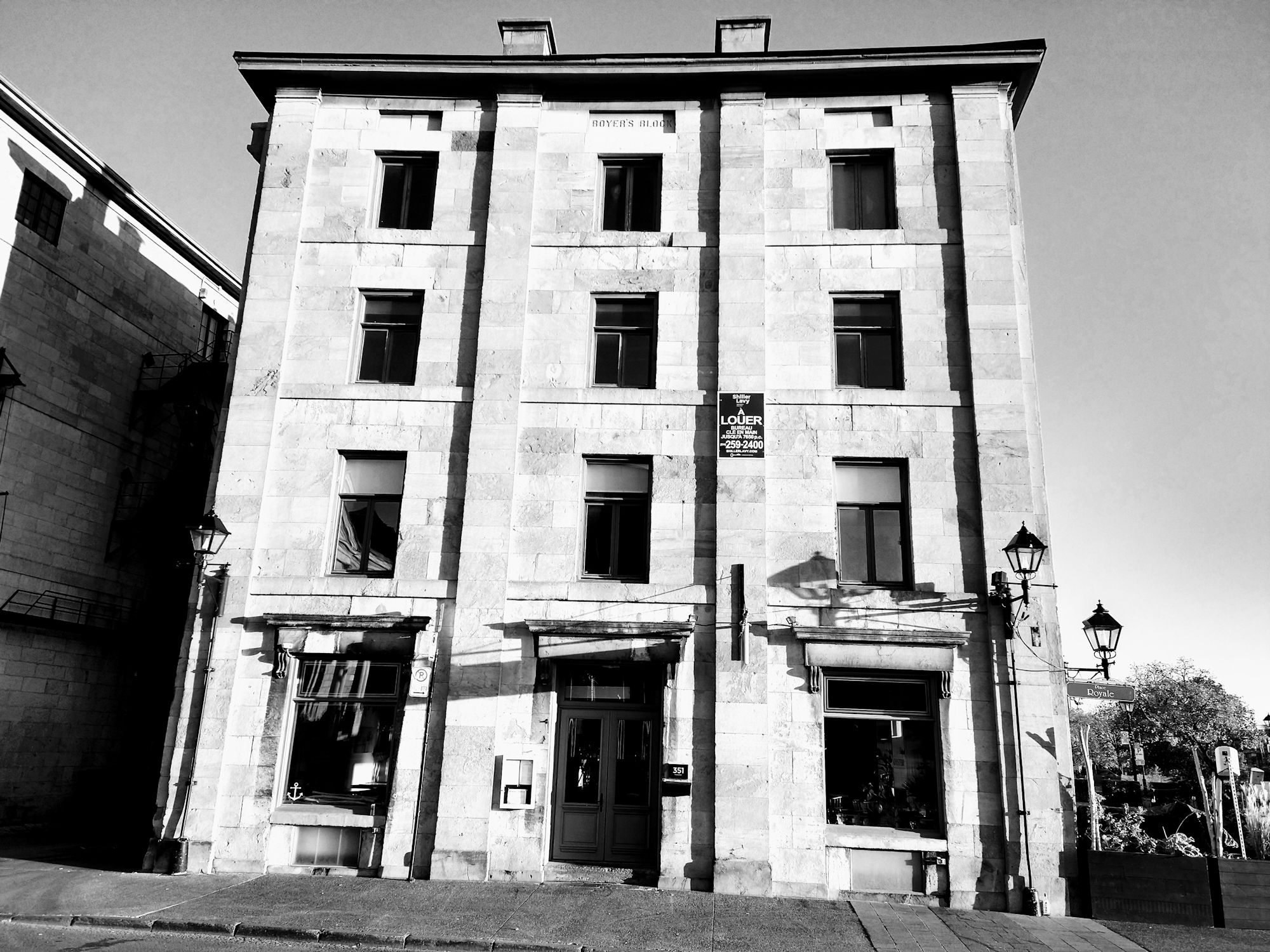
Boyer’s Block (133 Rue de la Commune / at Place Royale) – built 1857.
On north side of Rue Saint-Paul above Place Royale is an entrance to a building on Saint-Paul.

It’s up an alley, but is still Rue Saint-Paul.

Hidden away but is an historic monument.

Rue Saint-Paul.

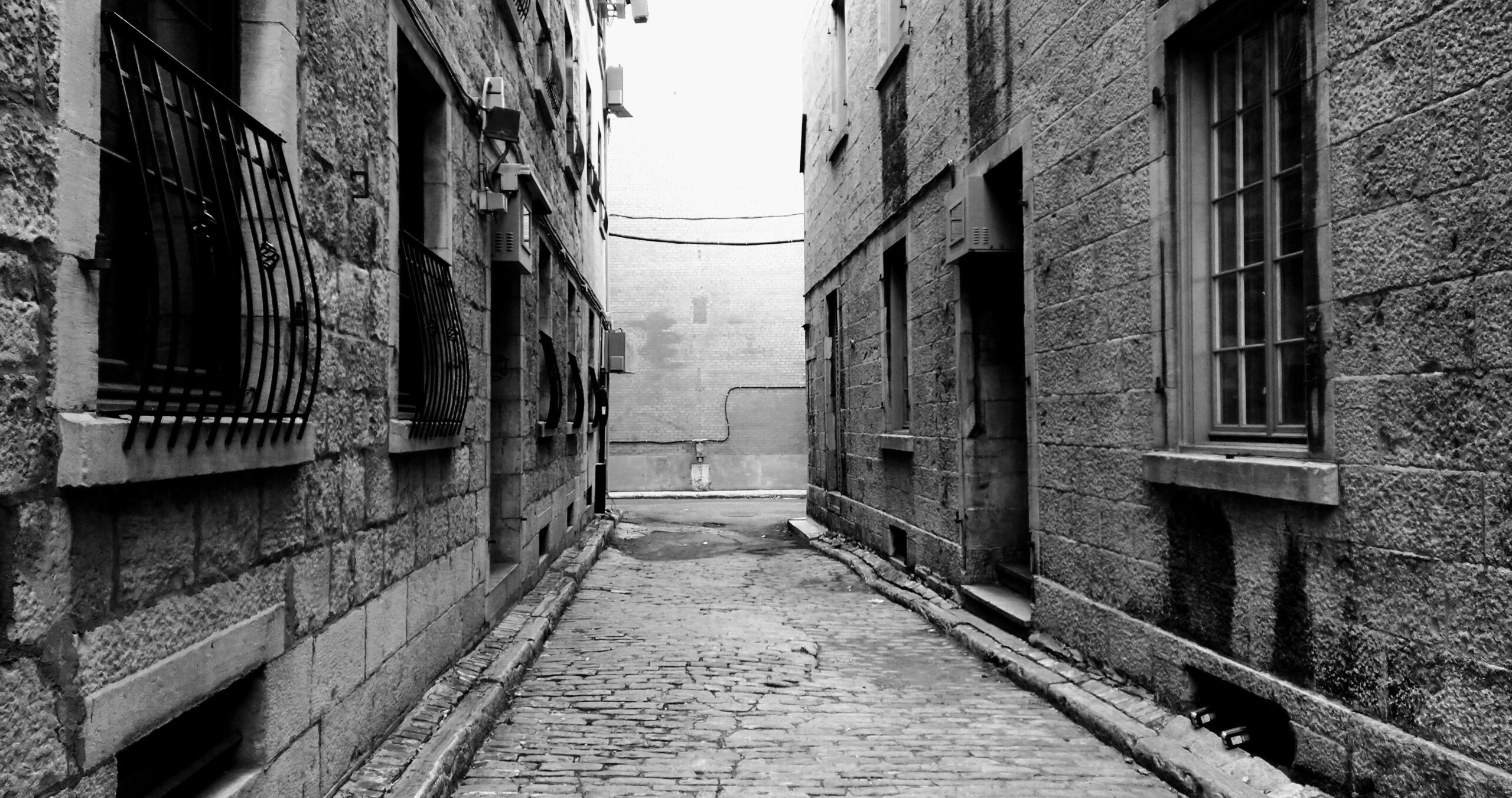
Ruelle Chagouamigon.

Ruelle Chagouamigon.

The solid wrought-iron window shutter and gate hinges and anchors are still evident and plentiful.

These hinge bolts are evidence of a time when these buildings shuttered all their windows and doors. Picture a Sunday in late 1700’s or early 1800’s, when all commercial shops are closed, and churchgoers have retuned home, and almost all windows and doors are shuttered closed.

Ruelle Chagouamigon.

Ruelle Chagouamigon.

Ruelle Chagouamigon.

Ruelle Chagouamigon dates back to late 1600’s and the name “Chagouamigon” echo’s of a distant trading post on the south-western edge of Lake Superior that was established by the coureurs des bois, Pierre-Esprit Radisson and Médard Chouart des Groseillers Below map is from Bellin, printed 1755, shows us how distant the western edge of Lake Superior is from Montreal.

Excerpt from Bellin 1755 map, showing the trading post at Chagouamigon.

In the late 1600’s, there was an annual fur fair in Montreal, where hundreds of First Nations would make the journey each year by water and land to Montreal to trade and sell furs. In the 17th and 18th centuries, furs accounted for 70% of all exports. Below is an excerpt from a 1909 Montreal Survey map showing the area around Place Royale, de la Capital, Saint-Paul and Chagouamigon. Even 200 years later in 1909, this area was still predominant as the fur market. Green circles highlight those establishments as fur wholesalers. (credit BANQ).

Rue de la Capitale.

Rue de la Capitale.

Rue de la Capitale.

Rue de la Capitale.

Corner of Rue Saint-François-Xavier and Rue de la Capitale.

Rue Saint-Eloi, at Rue Saint-Paul.

Maison Chartier De Lotbinière (221 Rue du Saint-Sacrement) – built 1811.

Maison Chartier De Lotbinière (221 Rue du Saint-Sacrement) – built 1811.

Corner of Rue Saint-Jean and Rue de l’Hôpital.

Rue Saint-Pierre.

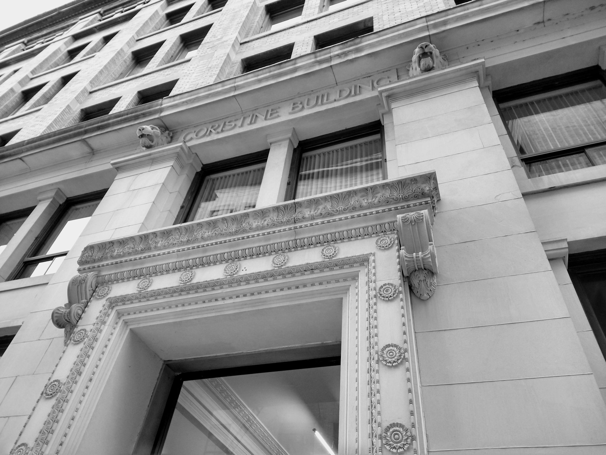
Coristine Building (corner Rue Saint-Nicolas and Rue Le Moyne) – built 1901.

Coristine Building – built 1901.


Coristine Building – built 1901.
Beardmore Building (417-419 Rue Saint-Pierre) – built 1902.
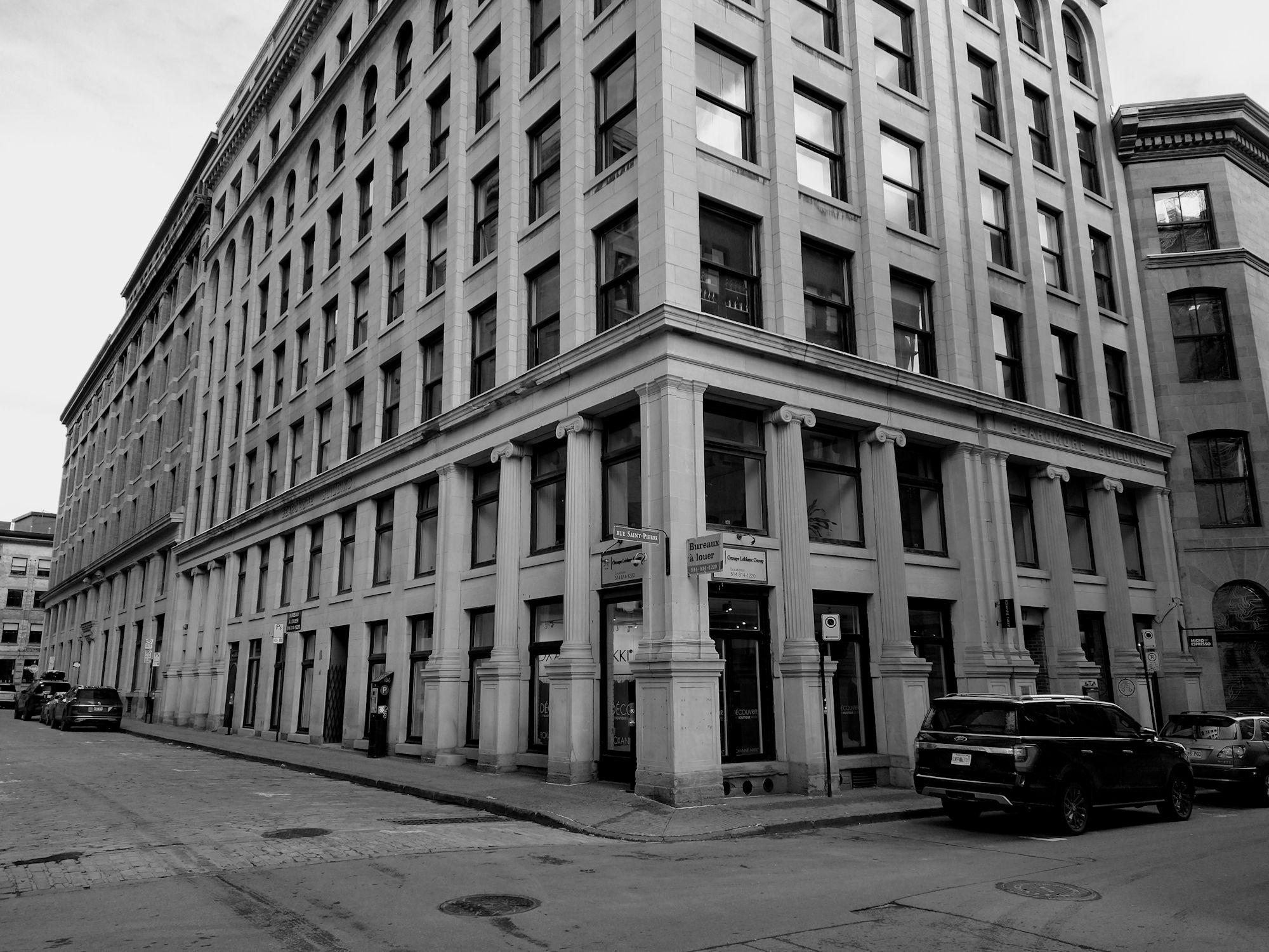
Beardmore Building (417-419 Rue Saint-Pierre) – built 1902.

Edmonstone, Allan Building (corner de la Commune and Marguerite d’Youville) – built 1859.
It was at this building that a telegraph was received of the RMS Titanic hitting an iceberg in 1912. (More about this when we do the “Montreal Harbour” walk in 2022).

Rue de la Commune.

Rue de la Commune.

Rue de la Commune.

Rue de la Commune.

Ghost signs.

Corner of Rue Saint-Pierre and Place d’Youville.

Corner of Rue du Port and Place d’Youville.

More “S- iron” anchor plates, predominant in these buildings for structural reinforcement. And more shutter bolt hinges.


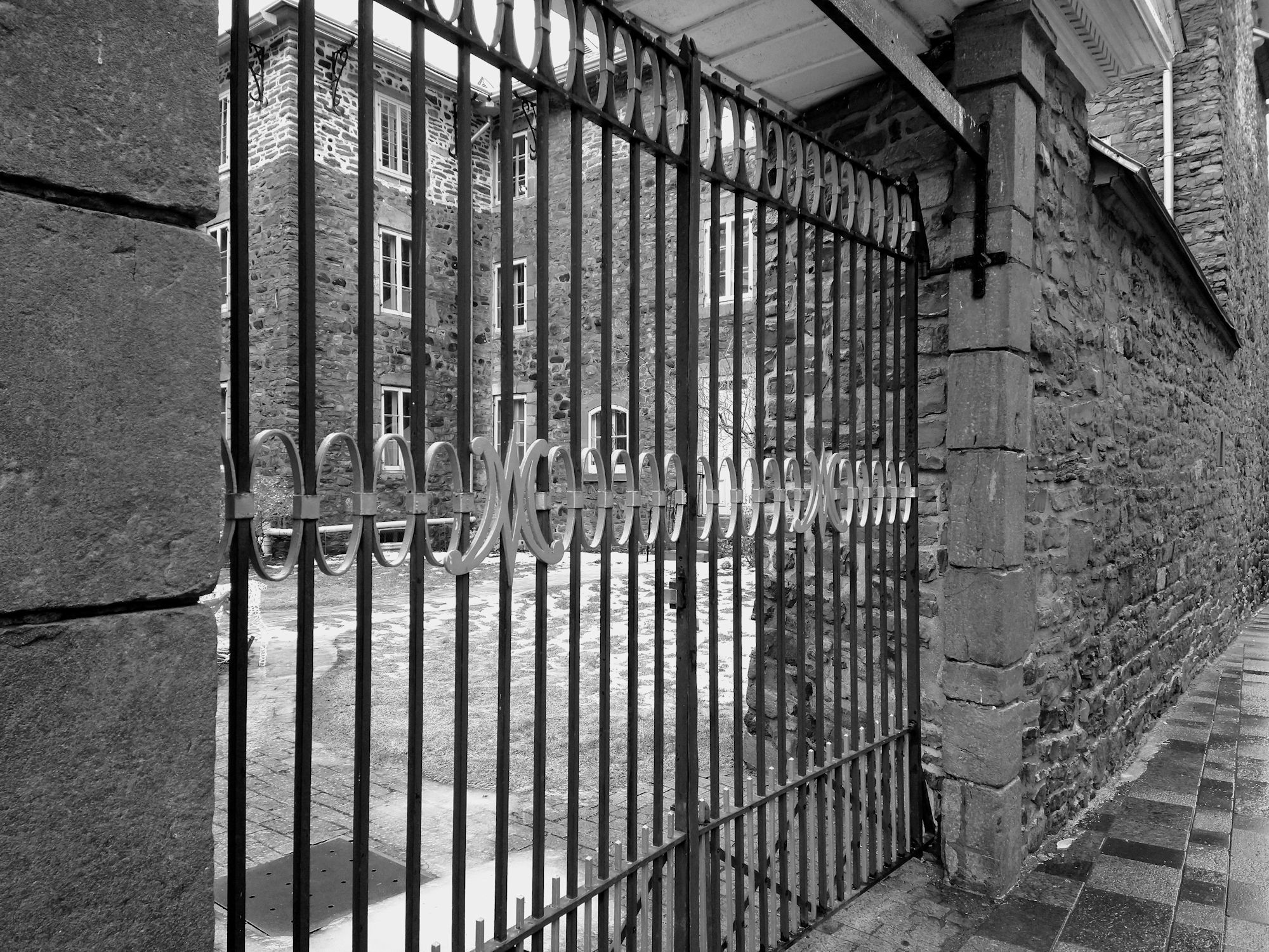
The Grey Nun’s Hospital (Rue Saint-Pierre) – built 1765.

An “S- iron” anchor plate, predominant in these buildings for structural reinforcement.

The Grey Nun’s Hospital.

Grand Trunk building (360 McGill) – built 1899-1902.

Grand Trunk building (360 McGill) – built 1899-1902.

Corner of McGill and Notre-Dame – looking east down Notre-Dame. This is where the Recollet Gate stood at the western entrance to the city.

Rue Saint-Jacques.

Molson Bank (278-288 Rue Saint-Jacques) – built 1864-1866.

Former Montreal Star newspaper building (235 Rue Saint-Jacques) – built in 1899-1900. Art Deco building.

Centaur Theatre / former Stock Exchange (453 Rue Saint François-Xavier) – built in 1903.

Fairy Land Building (480 Rue Saint François-Xavier) – built in 1869.

South-east corner of Notre-Dame and Rue Saint-François-Xavier.

Saint-Sulpice Seminary at Place d’Armes – built in 1684-1687. The clock was built in 1701.
This building is the second oldest structure in Montreal, built by François Dollier de Casson, a Sulpician priest. He also ordered the first street survey of Montreal and is responsible for the layout of Old Montreal streets.

Saint-Sulpice Seminary at Place d’Armes – built in 1684-1687. The clock was built in 1701.

Saint-Sulpice Seminary at Place d’Armes – built in 1684-1687.
Saint-Sulpice Seminary at Place d’Armes – built in 1684-1687.

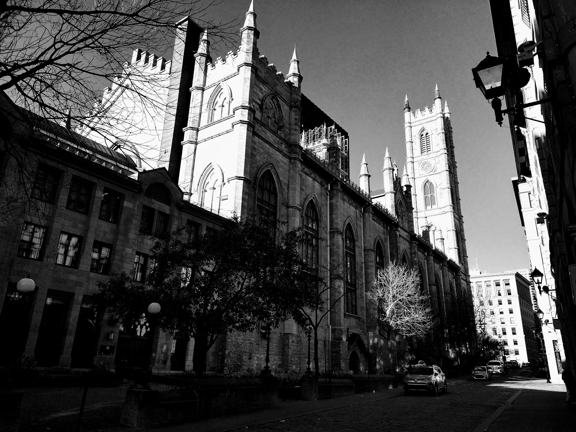
Notre-Dame Basilica at Place d’Armes – built in 1824 thru 1865.

Notre-Dame Basilica.

Notre-Dame Basilica seen from Rue Saint-Sulpice.
Rue Saint-Sulpice.

Maisonneuve Monument facing Notre-Dame Basilica at Place d’Armes.

Iroquois warrior at Maisonneuve Monument.

Place d’Armes, showing Bank of Montreal building with dome – built in 1847.

Place d’Armes – Aldred building in middle, the New York Life Insurance building on the left.

Aldred building at Place d’Armes – built in 1929-1931.
There are many Art Deco buildings in Old Montreal and the magnificent Aldred Building is one of them.

Aldred building at Place d’Armes – built in 1929-1931.

Aldred as seen from Rue Saint-Jacques – built in 1929-1931.

La Presse building (7 Rue Saint-Jacques) – built in 1899.

We hope you have enjoyed this walk. It doesn’t have to end here, you can continue on and find interesting buildings and charming streets on your own. Old Montreal is a spectacular area! We leave you with these two maps – one published in The London Magazine in 1760 and another map in 1758 by George Bishop and Co.. They clearly show how the original city was surrounded by a stone wall and on the outside of the wall, was a dry ditch on the west, north and east sides of the city. There was no ditch at the waterfront of course. The wall was a rampart about 18 feet in height and the ditch was about 8 feet in depth. There were several gates to the city, also shown on the maps.


What a wonderful collection of photos and information. I wish I had seen this before I took my son to Old Montreal – there were so many things we wanted to know, and you have answered many of them. I would love to see this in printed format – a real treasure! Thank you for your efforts.
Hi Susan, thank you for the kind words and very happy you like our website. Glad to hear you took your son to Old Montreal…a must see!
This is a fantastic resource. The pictures are stunning, and the historical background so helpful. I’m planning a trip to Montreal with my nephew, and I’m delighted to have found your site. Thank you so much for making and sharing this!
Thank you Susan. Hope you and your nephew have a great time in Montreal.