

(above photo is Winnipeg Street, in Hochelaga district – July 3, 2023) © WalkMontreal
WalkMontreal is pleased to bring you an invigorating walk thru Hochelaga, one of Montreal’s working class neighbourhoods. In the late 19th century, there was a flourishing cotton mill and weaving industry here, as well as railway maintenance shops and terminal locations. Overtime, this area would gain a reputation for poverty and crime. However, recent efforts on gentrification and cleaning up this area of Montreal has improved it. In the area that C & D walked, they found the streets to be clean and safe to walk and were approached by residents eager to talk about their streets. C&D will showcase the streets they walked as well as highlight a true hero who gave her life to save many children.
C&D did this walk on Monday July 3, 2023 from 2:45PM to 4:30PM. The total length was approx. 5.45KM (3.4 miles). The terrain is mostly flat and not difficult at all. It was a sunny day with some clouds and a temp. of 31C (88F).
We started this walk at Metro Préfontaine, at the corner of Hochelaga and Moreau streets. Start walking south on Moreau Street.

Corner of Moreau and de Rouen streets.


Keep walking south on Moreau Street.

Moreau Street.

Mural by Nick Sweetman.

Water Tower on Moreau Street.

Water Tower.

Corner of Ontario Street East and Moreau.

Cross Ontario Street East and keep walking south on Moreau.

Moreau Street.

Moreau Street.


When you get to the corner of Sainte-Catherine Street East, turn left and walk east.


At 3130 Sainte-Catherine Street East, you will find the original Hochelaga Post Office, built in 1901-02 in the Beaux-Arts style.


Corner of Sainte-Catherine Street East and Préfontaine Street. Walk north on Préfontaine Street.

Préfontaine Street.

Préfontaine Street at intersection of de Rouville Street.

Walking north we come to this structure at 1463 Préfontaine Street.

This is St. Mary’s Memorial Hall, built in 1924. It echo’s of an old Protestant English speaking community that had a significant presence in this area at the beginning of the 20th Century. About 15% of the population in this area was Anglophone.

St. Mary’s Memorial Hall.

St. Mary’s Memorial Hall.

St. Mary’s Memorial Hall.

St. Mary’s Memorial Hall.

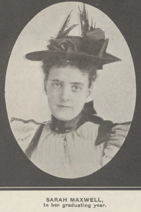
In 1890, Hochelaga Protestant School was built here on Préfontaine Street. A young teacher named Sarah Maxwell would soon become the principle of Hochelaga School and then tragedy would strike on February 26, 1907. It is believed a boiler exploded in the basement causing a fire that rapidly spread thru the school. As children were rushed out doors and windows, Sarah Maxwell stayed to the very end, grabbing children from the burning classrooms and handing them thru to firemen who had raised a ladder to the second floor window before she disappeared in the flames. When the firemen gained control of the fire, they entered the second floor of the school and found the bodies of Sarah Maxwell and 16 children. It is believed that Sarah Maxwell saved dozens of children before she herself was overcome by smoke.
Hochelaga Protestant School – Below photo from The Standard (Montreal), March 16, 1907.

Miss Sarah Maxwell – Below photo from The Standard (Montreal), March 16, 1907.
Hochelaga Protestant School was rebuilt as Sarah Maxwell School on Préfontaine Street. Below photo by Conrad Porier (BANQ P48S1P20198) in 1952.

Préfontaine Street. This is where the Hochelaga Protestant School once stood.

Préfontaine Street.

Corner of Préfontaine and Adam streets.

Lallemand Inc., located on Préfontaine Street.

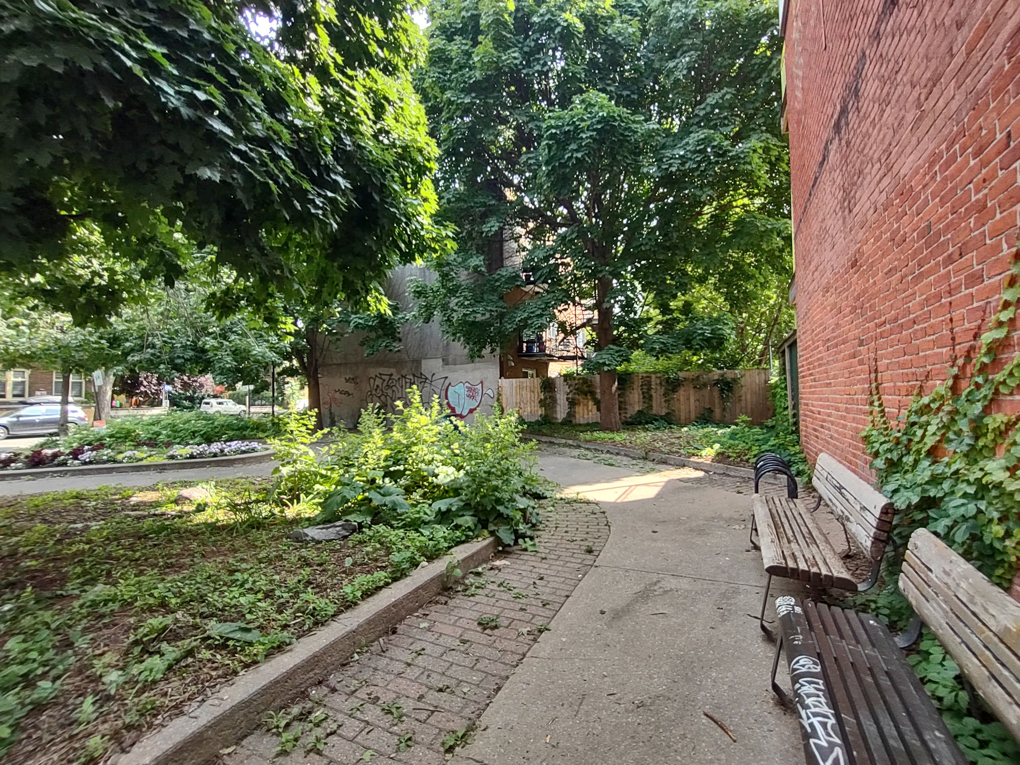
On the east side of Préfontaine Street, you will see Sarah-Maxwell Park.

Sarah-Maxwell Park.

Corner of Préfontaine and la Fontaine streets.

Préfontaine Street.

Préfontaine Street.

Préfontaine Street.


Intersection of Préfontaine and Ontario Street East.

Turn right and walk east on Ontario Street East.

Walk over one block to Dézéry Street. Here you will see Place des Tisserandes, that gives hommage to the spinning wheel mills and weavers that existed in this area in the 19th and 20th centuries.

Ontario Street East.

At this corner, we also find Église Nativité-de-la-Sainte-Vierge-d’Hochelaga, built in 1924.

Église Nativité-de-la-Sainte-Vierge-d’Hochelaga.

Église Nativité-de-la-Sainte-Vierge-d’Hochelaga.

Église Nativité-de-la-Sainte-Vierge-d’Hochelaga.

Église Nativité-de-la-Sainte-Vierge-d’Hochelaga.

Place des Tisserandes.

We are going to walk south on Dézéry Street.

Dézéry Street.

Dézéry Street.

Dézéry Street.

Dézéry Street.

Dézéry Street.

Dézéry Street.

Dézéry Street, at the intersection of la Fontaine Street.


We come to Sarah Maxwell Park again.

Sarah Maxwell Park.

Sarah Maxwell Park.

Mural by Dodo.

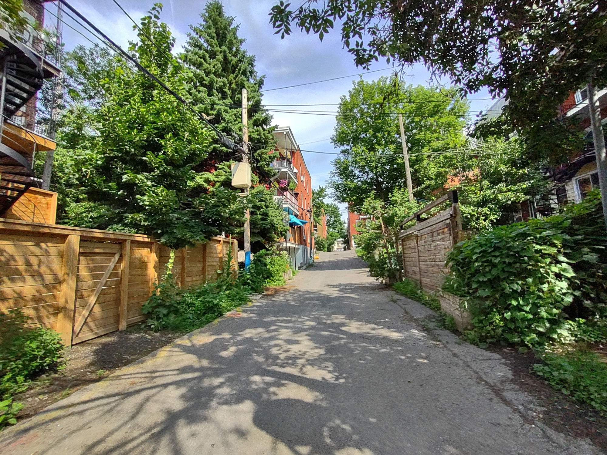
Running east off Dézéry Street is a well kept Ruelle.


Continue walking south on Dézéry Street.

Dézéry Street.
Dézéry Street.


We are now at intersection of Dézéry and de Rouville Streets. Turn left and walk east on de Rouville Street.

We come to a small park.

Rouville Park.

Rouville Park.

Rouville Park.
Rouville Park.

Corner of de Rouville and Saint-Germain streets. We will now walk north on Saint-Germain Street.

Saint-Germain Street.

Saint-Germain Street.

Saint-Germain Street, now crossing a small street called Provost.

Saint-Germain Street.

Saint-Germain Street.

Saint-Germain Street.

Intersection of Saint-Germain and Adam streets.

Intersection of Saint-Germain and Adam streets.


Continue walking north on Saint-Germain Street.

Saint-Germain Street.

Saint-Germain Street.

Saint-Germain Street.

We cross the Ruelle we saw earlier with a mural by Ola Volo.

Beautiful Ruelle.


Continue north on Saint-Germaine Street.

Saint-Germaine Street.

We now arrive back on Ontario Street East.

Turn right and walk east along Ontario Street East for half a block.

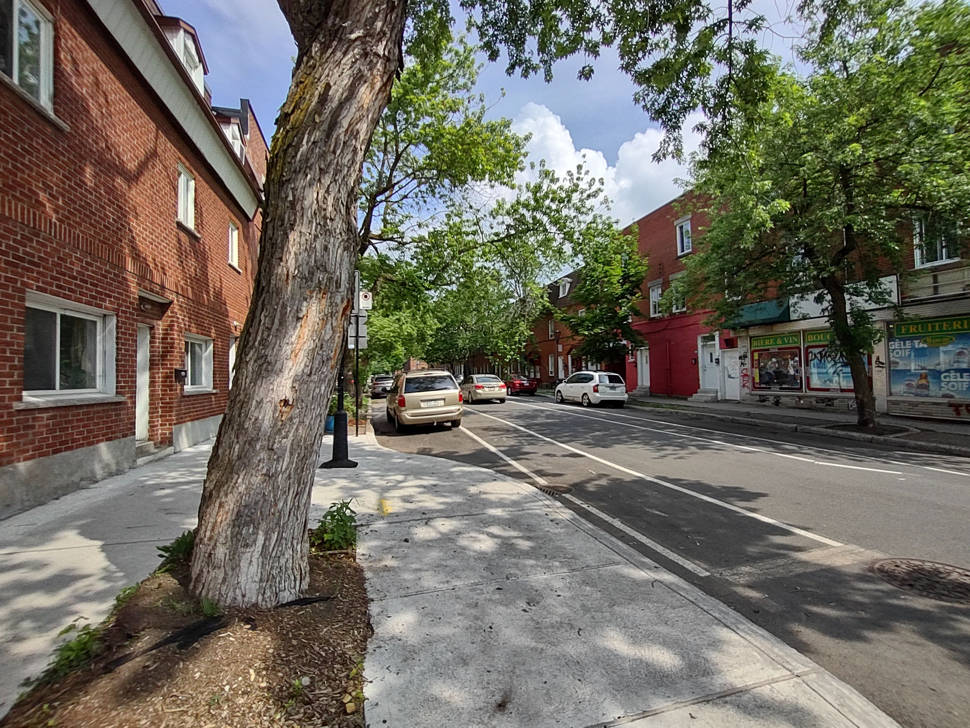
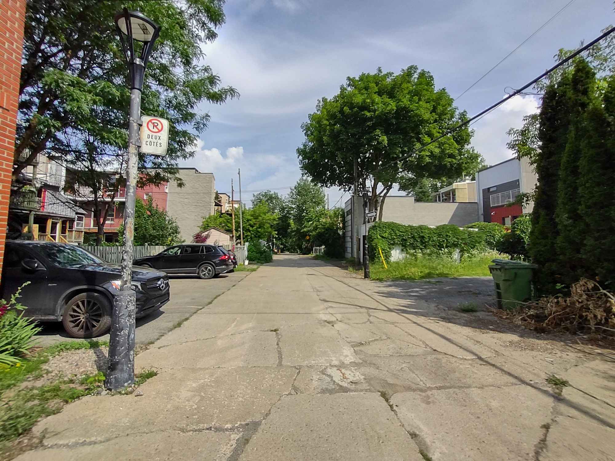
You will see what looks like a laneway, but, it is a street…Winnipeg Street. Lets walk down it….

Walking south on Winnipeg Street.
Winnipeg Street.

Winnipeg Street.

Winnipeg Street.

Winnipeg Street.

Winnipeg Street.

Winnipeg Street.

Continue walking south on Winnipeg Street. It is more like a Ruelle, but, is designated as a street.

Winnipeg Street.

Winnipeg Street.

Winnipeg Street.

Winnipeg Street.

Winnipeg Street.
As you exit Winnipeg Street, you will come to Adam Street. Turn left and walk east to the corner of Adam and Darling Streets.


Intersection of Adam and Darling streets. École Hochelaga, 3349 Adam Street, was built in 1922.
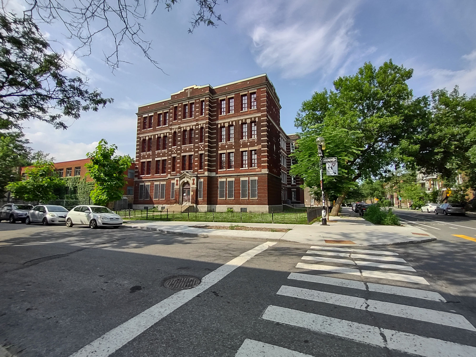
École Hochelaga.

École Hochelaga.

Walk north on Darling Street. You will pass by Hochelaga Park.

Go straight up Darling Street until you reach Ontario Street East.

Walk east along Ontario Street East.

Intersection of Ontario Street East and Davidson Street. We now turn right and walk south on Davidson Street.


Davidson Street.

Corner of Davidson and Adam streets.

When you get to Adam Street, turn left and walk east.

Walking east on Adam Street.

The domes of Église Très-Saint-Rédempteur can be seen in distance.

Église Très-Saint-Rédempteur, 3532 Adam Street, built in 1928.

Église Très-Saint-Rédempteur, 3532 Adam Street, built in 1928.

At 3603 Adam Street, you can see the facade of the original École Baril, built in 1911.

The facade of the original École Baril, built in 1911.

The facade of the original École Baril, built in 1911.

The facade of the original École Baril, built in 1911.


École Baril was named after Georges-Edmond Baril, a medical doctor, who was well respected in his community of Hochelaga. He was named “the doctor of the poor” and lived in this area to be with the people here.
Dr. Baril in 1894 – Below image courtesy of BANQ.

Intersection of Adam and De Chambly streets.


We now walk north on De Chambly Street.

De Chambly Street.

De Chambly Street.

De Chambly Street.

Alley off De Chambly Street.

Intersection of De Chambly and Ontario Street East.


Continue walking north on De Chambly Street.

De Chambly Street.
De Chambly Street.

De Chambly Street.

We have now walked to the corner of Hochelaga Street and at the corner is Fire Station No.48.

Fire Station No. 48, 3616 Hochelaga Street, was built in 1931 in the Art Deco style.

The walk ends here, as Metro Joliette is right beside it as well.

Below map is from early 1900’s. This is the area we covered in the walk. At bottom of map towards left, situated on the St. Lawrence River, you can see the location of the Cotton Mills.

Here is a photo titled “Montreal Cotton Factory, QC, about 1890” by William Notman (McCord Museum – View1923).
It shows a Cotton Factory on the shore of the St. Lawrence River, with Mount Royal in the distance to the west. This is the base of Hochelaga, where thousands of workers (men, women and children) worked six days a week. The smoke stacks were a reflection of industry, but, they were a witness to low wages, horrible working conditions and inequality. However, imagine a family living off the island that sees these smokestacks in the distance? They almost appear as a beacon of employment and hope for a brighter future.

We hope you enjoyed the walk and photos. The history of Montreal is truly amazing and what makes this city unique are its neighbourhoods and streets.
Hello, I Loved the post about Hochelaga and I saw these photos. I think you guys and gals are great. I used to live in Hochelaga near the Prefontaine metro and now I live in Maisonneuve not far from the Market. I would like to know if I could send you a file I have on St Henri. About maybe 15 years ago a professor Robert Cadotte had started a site Milieux défavorisés (L’enseignment en milieux défavorisés) his intention I believe was to create pages for many districts in Montréal. However, he only got as far as Hochelaga-Maisonneuve and St. Hénri. I found this site by accident and yes there are a few schools pictured in the file but there are many old houses and also some of the buildings that you have photographed but I used the site in a few of my own ramblings. I had to print it out since I think the professor stopped the project and no one updated the sites. And they are no longer available. I would like to send you the map and legend (thumbnails) as I thankfully printed stuff out. I can send you the St Henri walk if you let me know where you would like.